Mount Huashan Hike & Plank Walk – Public Transport Day Trip from Xi’An
TL;DR
Everything to need to know about your diy visit to Mount Huashan in China.
On our recent backpacking trip to China, we hiked Mount Huashan – yes, the one with the famous plank walk that is also dubbed the most dangerous hike in the world.
Here’s everything we would have loved to know before we went including:
- The best way to go from Xi’an to Huashan by public transport.
- Logistics while you’re there.
- Costs and entrance fees.
- How to create an easy(-ish) hiking route.
- Things to know about the plank walk.
And more.
- DIY Huashan Mountain Travel Guide
- How to Get to Mt. Huashan
- Mount Huashan Hike
- Deinfluencing the Mount Huashan Plank Walk
- Mount Huashan FAQ
DIY Huashan Mountain Travel Guide
How to Get to Mt. Huashan
Mount Huashan Map
Mount Huashan is located around 120 km (75 mi) east of the city of Xi’an.
How to Get from Xi’An to Mount Huashan
You have three main options to go to Mount Huashan from Xi’an:
- The train (30 min, 54.5 RMB)
- The bus (2 Hours, 42 RMB)
- A tour
After considering our options, we chose to take the train.
How to Take the Train from Xi’An to Mt. Huashan
Multiple trains per hour leave from Xi’an North Train Station to Huashan. They do sell out (trust us, we learned the hard way). We strongly advise you to buy a ticket in advance – especially if you want to take the first train of the day to arrive as early as possible.
The train ride takes just under 30 minutes.
Once you arrive at Huashan Station, there are shuttle buses that take you to the Mt. Huashan scenic area ticket office.
On the way to the ticket office, we took the bus from the bus station right next to the train station for 5 RMB. On the way back, we managed to catch the free bus from the Huashan scenic area ticket office back to the train station (don’t worry, we have marked every stop on our map).
Mount Huashan Scenic Area Ticket Office
At the Mt. Huashan scenic area ticket office, you buy your entrance ticket for 200 RMB.
Afterwards, you hop on another shuttle bus to the cable car.

Mount Huashan Cable Car
Two cable cars lead to Huashan Mountain:
- West Line Cable Car
- North Line Cable Car
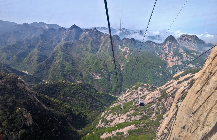
The west line is your best choice if you want to do some leisurely hiking and check out the famous Huashan Plank Walk.
The north line is your best choice if you want to do some serious hiking and see all 5 peaks.
We opted for the west line 😅
A one-way ticket costs 140 RMB, and a round-trip ticket costs 280 RMB.
The cable car is quite steep and the views from there are already amazing.
You have to
- Take the cable car down.
- Take the shuttle bus from the cable car station to the Huashan Scenic Area ticket office.
- Take another bus from the Huashan Scenic Area ticket office to the train station.
The first shuttle bus drops you off in some kind of shopping centre. It took us what felt like ages to reach the exit.

Mount Huashan Hike
The 5 Peaks of Mt. Huashan
In contrast to popular belief, there is more to see on Mt. Huashan than the famous plank walk. The mountain is also known for its 5 peaks
- West
- South
- East
- North
- Center

Mount Huashan Hiking Routes
As we are not avid hikers, we chose the easiest option:
We
- went up the west line cable car
- walked over the ridge to West Peak
- looped around
- hiked up South Peak
- went further to the plank walk
- hiked back to the west line cable car via Central Peak
The walk back from the crossroads we have marked on our map to the west line cable is mostly flat.
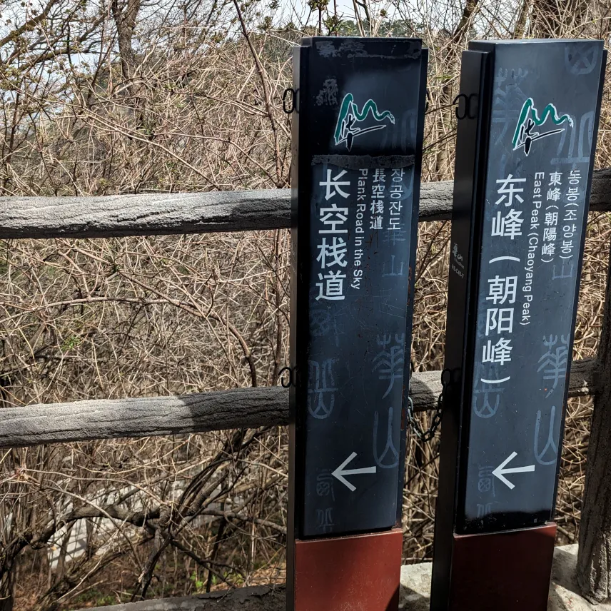
More avid hikers can also check out East Peak and the Chess Pavillon.
The most avid of hikers can cross the Black Dragon Ridge, head up North Peak, and descend via the north line cable car – or do the hike the other way around.
Is Hiking Mount Huashan Tough?
Honestly, we weren’t quite sure what to expect when embarking on the “most dangerous hike in the world”. The reality of hiking Mount Huashan is that 99% of the hike is made of flat perfect concrete steps.
The only tough thing is climbing up and down the stairs.

The Hiking Trails on Mt. Huashan Are Crowded!
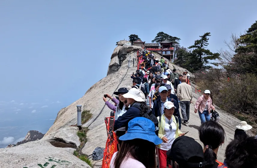
All the hiking trails are absolutely packed with people! You have to stand in line to reach the actual peaks and weave through tons of other hikers on the trails.

Deinfluencing the Mount Huashan Plank Walk
The Truth About the Huashan Plank Walk
Let’s finally get to the world-famous Hua Shan Plank Trail, shall we?
As we already know, the majority of the Mount Huashan hike is sturdy concrete and very far from dangerous.
So what is the plank walk? It’s a tourist attraction!
We were actually quite disappointed to learn that the Instagram famous plank trail is not much more than a photo spot.
How Does the Huashan Plank Walk Work?
You have to stand in line to buy a ticket for 30 RMB. The entrance fee includes a harness with a safety rope.
There are free lockers for your stuff. If you don’t want to take your phone, you can get a photographer for 60 RMB per picture.
People are let on the plank walk in groups. There’s only one trail so people go in and out the same way – the narrow path can get pretty crowded.

Mount Huashan FAQ
Are there Toilets on Huashan Mountain?
Yes, there are toilets on Huashan Mountain although not too many. For example, we used the ones next to the plank walk. They were far from clean but did their job.
Hiking Huashan Mountain as a Non-Chinese Speaker
Like everywhere in China, we never had any problem getting around with English. All signs are bilingual and we always found English-speaking staff.
We were some of the very very few foreign tourists on the hike and a lot of Chinese hikers smiled, greeted us, and exchanged a few (English) words with us.
Navigating Mount Huashan
All the trails are clearly signposted in English and Chinese.
You can also use the Organic Maps app if you want to have some (offline) maps with you.

How Long Does a Mount Hua Shan Day Trip from Xi’An Take?
You have to prepare for a long day. The hike itself takes around 6 to 10 hours depending on your speed and route. You have to add on at least two hours for the way from Xi’an and another two for the way back.
Can You Buy Food and Drinks on Huashan Mountain?
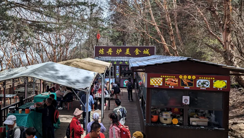
We had read online that you should bring enough snacks and water for the hike. But this is China. Of course, you can buy food and drinks at various spots along the trail.

Disclaimer: This post contains affiliate links. If you use these links to buy something we may earn a commission. You would help us a lot if you do so. Thanks.
